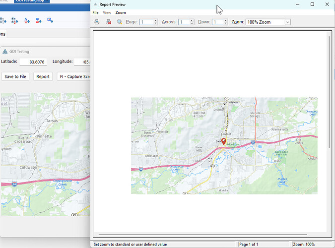
Has anyone used NetTalk Map Controls to display a map on a report form?
I’m not going to say it’s impossible but, out of the box, it will not do it.
I was able to do it once a long while back and it was not trivial.
Also, NT desktop maps are not designed with reports in mind. There’s A LOT going on behind the scenes to make the map work. Multiple web client objects on different threads and such.
What I did for the report was create an image file from a map control. Basically a coded screenshot. Then placed that image on a report.
I reached out to Bruce at Capesoft and he basically said the same thing, save the map as an image file. What I am not sure of is how to create to an image file from the map control. I was hoping that someone has done this before and can share with me what they did.
I’ll see if I can find my code from before. It’s been a while.
Don, thanks it will be much appreciated.
What version of Clarion are you using?
Window with Map !-----------------------------------------------------------------------------
fi FreeImageClass
      fi.iImage.CaptureScreen(?MapImage{PROP:Handle})
      fi.iImage.SaveAs('MapImage.bmp')
Report !----------------------------------------------------------------
ThisReport.TakeRecord PROCEDURE
ReturnValue          BYTE,AUTO
SkipDetails BYTE
  CODE
  Report$?image1{Prop:text} = 'MapImage.bmp'
  ReturnValue = PARENT.TakeRecord()
  PRINT(RPT:Detail)
  RETURN ReturnValue
I am using Clarion 11.1
I implemented the code as you provided and it works wonderfully. This is just what I was looking for. Thank you very much.
Awesome! I’m glad you got it working!
